The permitting process for offshore wind developments is split into four phases: planning and analysis, leasing, site assessment, and construction and operations. Environmental concerns are built into each phase, including a Site Assessment Plan (SAP), Construction and Operations Plan (COP), both of which are set before construction begins, and a cumulative impacts assessment, which takes into account broader ecological, sociological and economic factors.
Using ultra-high resolution digital aerial surveys, APEM Inc provide fast, reliable data for the offshore wind industry. From the planning stage, we provide spatial and temporal distribution and abundance data on birds and other wildlife, including those species listed under the Endangered Species Act.
Surveys should go far and wide…
Once a planning area has been identified, surveying can begin. APEM Inc recommend going far and wide with high-resolution aircraft-based surveys, which are ideal for capturing vast amounts of information quickly and in fine detail. A survey buffer of up to 10km away from the wind farm itself allows for mitigation measures, as current evidence suggests species such as the red-throated loon are highly susceptible to displacement at great distances from offshore wind farm activity.
To detect disturbance and displacement impacts, a key consideration for survey design is even distribution of analysed coverage across the site. To provide the most robust, statistically rigorous method of sampling, APEM Inc recommend a grid-based design, which sample at a much finer scale and assess multiple distances from the proposed development.
Because plans can change, surveys should be future proof. Once the area has been surveyed at a fine scale, no matter how a developer changes the plans for a proposed offshore wind farm within the site boundary, the data available will always be of the same quality and offer the same coverage.
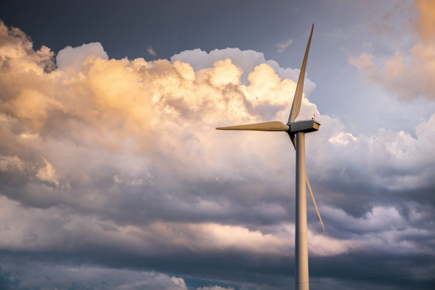
…and high and low
Developers need accurate data to see if birds are flying at rotor-swept height, to assess potential collision impacts and mitigate precautionary engineering spending on adjusting the air draft. This is particularly important for floating wind farms, as the ‘envelope’, or the area covered by a turbine, changes with the height of waves.
To obtain accurate, species-specific data on collision risk, we use LiDAR technology to accurately measure bird flight heights. An innovative use of laser technology, LiDAR uses an aircraft-mounted sensor that fires out a series of laser light pulses to create an accurate 3D picture.
Fine details
For identification of endangered species such as roseate terns, ultra-high resolution imagery is an essential tool that can identify a species from a single image. Images are obtained with pinpoint accuracy at 1.5cm GSD (ground sample distance), meaning that each pixel in the image represents 1.5cm2 – a resolution that has to be seen to be believed!
In post-construction monitoring, reports are undertaken on changes in avian habits. Thanks to spatial planning and bird flight height modelling, we have seen that seabirds have altered their courses and flight heights to avoid wind turbines.
Frequency and time
Marine mammals, birds and fish often have a seasonal distribution, so year-round surveys undertaken every month will gather data on their feeding, breeding and migration patterns.
There are no set time scales for the four phases of offshore wind permitting. However, we recommend that surveys during the planning and analysis stage should be undertaken for a minimum of two years. Post-leasing will see production site characterization and site assessment plans, which usually take up to five years to produce. The construction of wind farms usually takes around two years, and throughout the life span of the wind farm and its decommissioning, ongoing monitoring will take place.
Renewable energy technology is changing at great pace, so the final consideration is time. The right data is future-proof: transparent, robust and reusable. APEM Inc provide accurate data that fits into our clients’ systems to provide a reliable baseline, and that can be used multiple times for long-term monitoring.
To see more of our amazing imagery or to talk about the technology we use, contact APEM Inc here.