APEM Inc undertake large-scale mapping projects for linear assets and route analyses, using specialist cameras mounted on twin-engine aircraft.
Ideally suited to linear route mapping, our specialist technology generates topographic 2D and 3D outputs over large distances which are often inaccessible.
As a global leader in aerial survey corridor mapping of natural and human-made linear features, we look at our clients’ existing linear assets and map out proposed routes for new installations.
APEM Inc are a global leader in aerial survey corridor mapping of natural and human-made linear features. Clients from the utility and construction industries commission us to undertake aerial surveys of their existing linear assets and to map out proposed routes for new installations.
Aerial survey corridor mapping is used by our clients in the water industry for leakage detection: using our multispectral camera systems, we identify leaks in underground pipelines, saving our clients time and money in waste and repairs. We provide mapping of pipelines buried several feet below the ground.
Topographic surveying uses a powerful 3D tool for route optimization and cable route surveys. Our surveys produce topographic data and high-resolution imagery that highlights obstacles to construction before they cause problems.
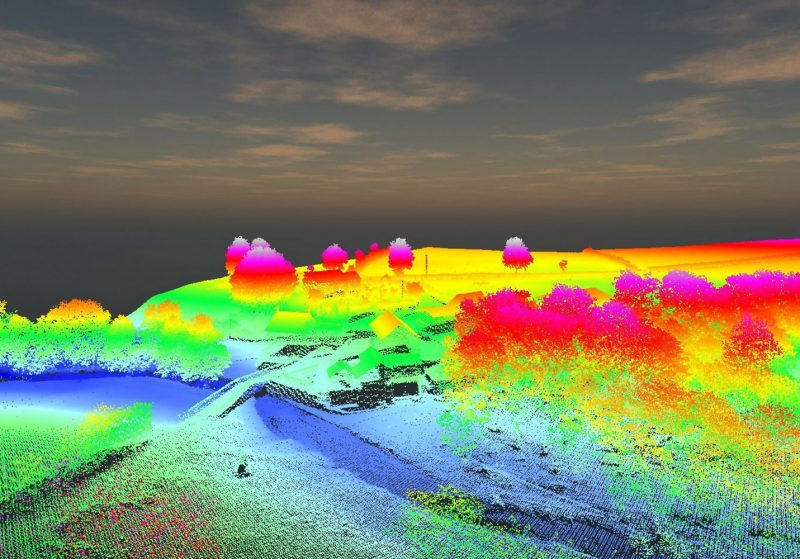
LiDAR is a tool for asset mapping, producing detailed topographic data for route corridors and Rights of Way, and a visualization of above ground features such as buildings, pylons and transmission lines.
For the Infrastructure industry, earthworks calculations are invaluable, and our highly accurate 3D data allows our clients to manage volumes such as stockpiles, embankments and cuttings on construction projects. Where overhead lines are a factor, our aerial surveys can provide a vegetation risk assessment, identifying the proximity of vegetation to lines, and network strike risks from trees.
Aerial surveys for rivers include habitat surveys and restoration works, creating 3D models of flood plains and river banks, mapping fish spawning habitats within river channels and identification of invasive species.
Specialist sensors and data processing technology capture LiDAR and/or ultra-high resolution imagery at a resolution greater than 2 cm Ground Sample Distance (GSD) in multiple wavebands from RGB to near-infrared.
Our technicians generate high-density topographic datasets such as point clouds, digital surface models and digital terrain models. We can create accurate ortho-mosaics, photo-realistic 3D models and 3D virtual flyovers, which are great for visualization and stakeholder engagement.
Time benefits: our sensors survey tens of kilometres of linear assets in a single day, allowing us to provide a snapshot of an entire project from a single survey. Remote and inaccessible areas pose no problem for aerial surveys, unlike traditional ground surveying methods.
Our innovative approach to corridor mapping removes delays caused by land ownership and access issues, bringing significant health and safety benefits for our clients by minimising the number of ‘boots on the ground’.
The team at APEM Inc would be happy to answer any questions you have about aerial surveys for linear asset and route mapping. Please use the form below to get in touch.
Read one of APEM Inc’s blogs, news articles or case studies to find out more.
APEM Group further invests in LiDAR technology

The Remote Sensing team at APEM Group have recently taken delivery of three LiDAR systems to support their services to clients across the globe.